Maps As Narratives
In today's world, reporting on the news is as prevalent in social media (Facebook, Twitter, YouTube, Instagram) as it is in conventional media outlets (TV, newspapers, radio, websites). In the summer of 2014, as conflict erupted in Israel and Gaza, the world watched in real time as the story unfolded. First-hand accounts were uploaded by witnesses to the conflict immediately as the events were taking place. Like with so many other news events nowadays, the presence of social media reporting is changing the way the world views conflict.

Program Description
This section focuses on maps as an interpretation of reality. You may want to start this section by having your learners create their own maps. We suggest drawing a map of the educational setting they are in. Be sure to choose an area to represent all learners. Whether they are assigned to draw their neighborhood or the area around their school, the exercise of determining how to reflect reality with two-dimensional lines and words can be very illuminating. Challenge them to create simple maps that highlight details they feel are important for a new student coming to the school.
Questions to consider:
- What are the important spots to include? Does it change if the student is younger or older?
- How would they represent different spaces and the functions they serve?
- Are there special places that they feel compelled to include?
As they look at each other’s maps, encourage your learners to think about what they can infer from what they see.
- How did they decide what to include and what to omit?
- What differences stand out? What is the significance of the differences?
- If one of the maps includes places or information not included in other maps, is one map “correct” and the other “incorrect”?
- How do you react to the fact that a space was represented in different ways? Why might we represent the same space in different ways?
Examples to consider:
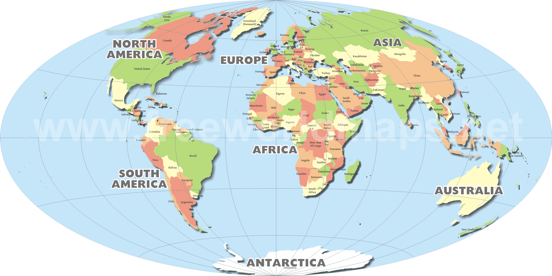
The World Map
This is the traditional world map that you may see in a social studies classroom or textbook. It is known at the mercator projection and attempts to show the earth with curvature, and places Europe at the center.
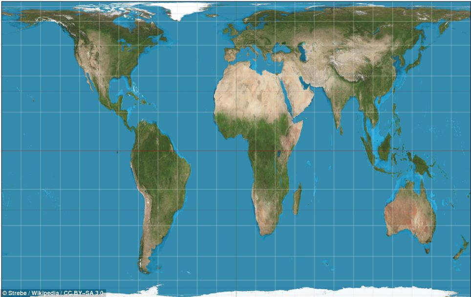
Gall-Peters Projection
Published in 1974, this map attempts to show the land masses in proportional relative size.
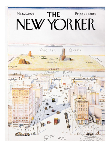
The New Yorker Map
A famous cover of the New Yorker magazine which attempts to depict the typical New Yorker's view of the rest of the United States:
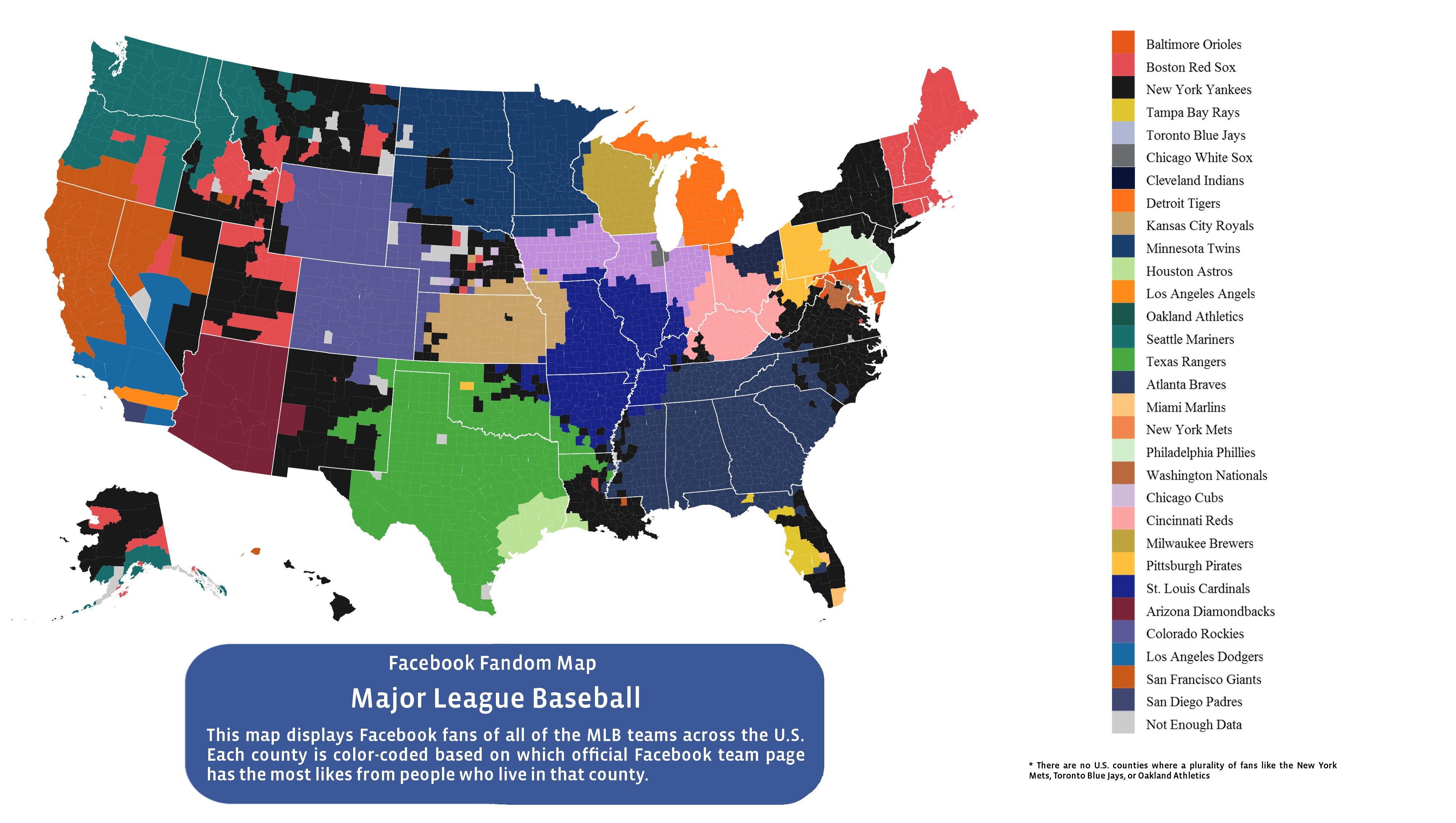
Baseball Fans Across America
A map distributed on Facebook, which ovelays baseball team fan loyalty on the map of the United States.
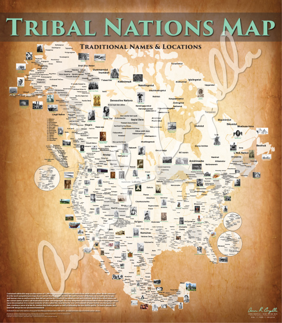
Tribal Nations Map
Maps by Aaaron Carapella that use Tribal Nation’s original indigenous names for themselves, and show where Tribes were just before contact with outsiders. (source: http://www.tribalnationsmaps.com/)
Questions to consider:
- What is different about the world when one looks at it through a particular lens, as shown by these different maps?
- What makes one map more appealing or less?
- What new insights can be gained from different maps? How might these new insights shape our worldview?
- How might a map be used to convey information or a message?
- What are the messages the creator of these maps are trying to convey? How might the maps have been altered to convey a different message?
If your learners created a map during Section One, you may want to ask them how they would change the maps they drew based on their study of these maps. Would they want to emphasize new things? What – or whose – point of view is represented in each of the maps that learners created?
Using questions that are similar to the ones used in Section Two, share a variety of maps of Israel with your learners. Examples are below.
Let your learners engage with these maps or others that you think will encourage meaningful encounters. Provide an opportunity for individuals and small groups to compare and contrast the various maps, and to wrestle with some of the questions listed above.
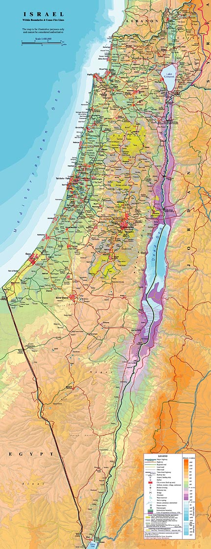
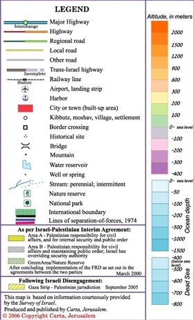
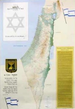
Example #1: This is a map posted on the Israeli Foreign Ministry’s official website, created in 2006. What can you learn about the territory displayed on the map by applying the legend to your study of this map?
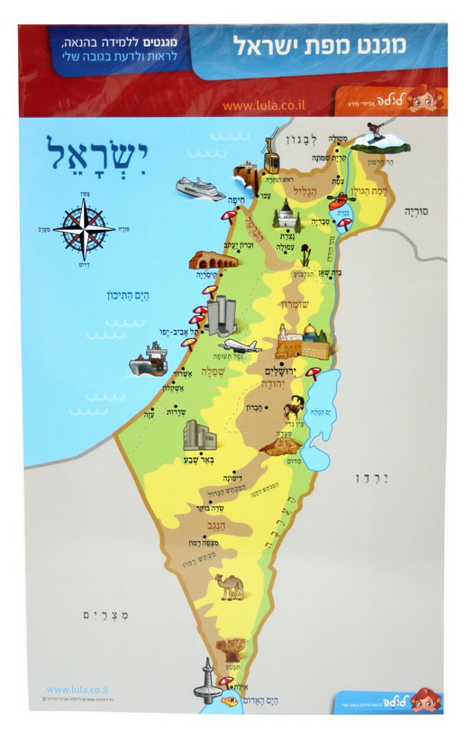
Example #2: This is a magnet, similar to one that you might buy in an airport gift shop, that depicts an illustrated map of Israel with Hebrew place names.
Example #3: This is a representative version of a map that hangs in the classrooms of many Jewish schools in the United States.
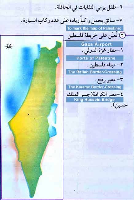
Example #4: This map, which can be found at the top of page 43 of the following report from The Washington Institute, comes from an official Palestinian Authority textbook. http://www.washingtoninstitute.org/uploads/Documents/pubs/PolicyFocus124...
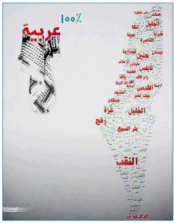
Example #5: This map which also can be found in The Washington Institute report comes from a Fatah Facebook page and says “100% Arab.”
Example #6: This map is published by the Palestinian Authority
[CURRENT STATUS MAP TO BE POSTED]
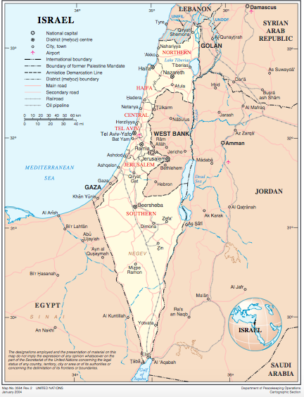
Example #7: This map is published by the United Nations. Read the labels with care. Where is Israel’s capital?
Questions to consider:
- What is different about how Israel is seen when you look at it through a particular lens (with or without lines delineating the West Bank and Gaza, borders with annotated comments, etc.)?
- Do you react differently when you see the areas on the map labeled in Hebrew, English, or Arabic?,
- What new insights do you gain from the map? How might these new insights shape your worldview?
- Discuss the messages you think this map conveys. Do you agree with them? Why or why not? How might the map have been altered to convey a different message?
- If you have a map of Israel in your classroom, or in the school, how do these maps compare? What can be inferred from the map that you generally refer to?
If your learners created a map of Israel at the beginning of this unit, you may want to ask them to share their individual maps with each other. What similarities and differences do they see between their maps and what is significant about them?
Conclude this section with questions that help learners synthesize the different messages and intentions they perceived from the various maps they studied.
- What surprised you about some of the maps you saw?
- In what way did these maps encourage you to think differently about Israel? About Israeli and Palestinian claims and aspirations?
- Why do you think the school displays maps of a certain kind? Describe the benefits if different maps were on display.
Supporting Images

